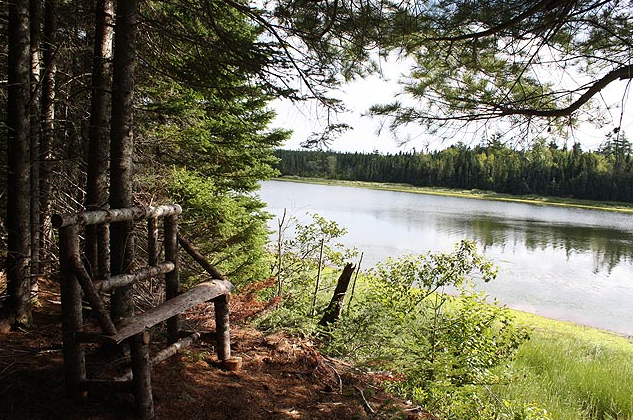
A marked 4.5km woodland trail follows along the north bank of the Boughton River. Access to the trail is located on the east side of the bridge in Bridgetown. Signage describes wildlife species and their habitats found in the riparian zone and estuary of the river. Interpretive signage on the early settlement and why the river was so important to the settlers.
The trail is moderately difficult with steps, a few short but steep hills and the odd low protruding root to step over. Sturdy walking shoes or hiking boots are recommended. It will take 3-4 hours to walk the whole trail and back. At the half way point a small island, called Johnson’s Island, is surrounded by a salt marsh. A viewing tower is located at the south end for bird watching.
Pack your own canoe or kayak for paddling, a 12.5km water trail that runs the full length of the Boughton River estuary with six docking stations. The trail-head is located upriver in Bridgetown. Along the water trail are five tie-up stations that provide a place to picnic, rest and explore.

For approximately 5km, the water trail flows through undeveloped forested land. This section is sheltered, and the water is unusually calm. Common wildlife sightings include: seals, bald eagles and belted kingfishers. Further downriver, mussel farms are delineated with buoys.
The trail ends in Boughton Bay; to the north is the fishing village of Annadale and to the south is Old Ferry Spit, one of eastern PEI’s tranquil barrier sand spits. Upriver from the spit is the remains of Long Wharf. All the stations along the Boughton River Water Trail are located in the estuary. To ensure that your trip is enjoyable consider tide conditions. To paddle with the tide, begin a trip downriver at high tide and a trip upriver on a rising tide. Tide charts and a map of the navigation channel are displayed at the slipway in Bridgetown. The trip downriver can take 4 hours in a canoe for average paddlers making stops along the way.
Clay’s Tie- Up station (1.25km upriver of trail-head)
Boughton River Hiking Trail tie-Up station (0.5km downriver from trail-head)
Graystone Tie-up station (2km downriver of trail-head)
Long wharf road station (10km downriver of trail-head)
Annadale Wharf Station (11km downriver of trail-head)
Bridgetown Tie-Up Station (Trail-head):
The Bridgetown Tie-Up station is the trail-head of the water trail. The trail-head offers parking, picnic tables, information about the Boughton River Watershed, and a slipway with floating docks to accommodate visitors. Channel depth is approximately 2-meters at low tide.
Clay’s Tie-Up Station(1.25 km upriver of trail-head):
Clay’s is the only station upriver and is difficult to paddle at low tide. Paddling at high tide is recommended. The station has access to Route 328. This station is where paddlers turn back and head back down river. Another 0.75km upstream is Ross’ Dam, a 3-meter high impoundment once used to hold water for three mills. Chanel depth is almost 0 at low tide.
Boughton River Hiking Trail Tie-Up Station (0.5km downriver from trail-head)
A short paddle of 0.7km downriver comes upon the Hiking Trail station. Disembark here and explore the natural riparian zone of the Boughton River while hiking the interpreted River Trail where many native plants and animal species thrive. The trail is a great spot for viewing woodland warblers such as the Black-and-white, Black-Throated Green and Black Burnian. The 4km Hiking Trail begins in Bridgetown. Approximately 1.5km downriver and connected to the hiking trail is an observation deck for bird watching. Chanel depth is over 2-meters at low tide; however it does not have an access road.
Graystone Tie-up station (2km downriver of trail-head)
Located just downstream of the mouth of Graystone Creek, on provincial land managed by the P.E.I. Forestry Division, is the Graystone station. There is access to the Green Hill Loop Road nearby by following the path along the bank. The Chanel is over 4-meters deep at low tide.
Long wharf road station (10km downriver of trail-head)
Approximately 2km downstream from Graystone tie-up station, the river opens up and windier may be experienced. The buoys of the mussel lines are easily identified and paddling through these generally does not cause difficulty.
This station is near the a ferry wharf called Long Wharf. The channel is deep, but the current is not strong. The Long Wharf Road extends right to the water’s edge. There is no dock at this site, but there is plenty of shallow sandy shoreline to beach on. The walk along the shore and around the sand spit is an opportunity for exploring.
The Old Ferry Sand Spit is frequented by many shore birds such as willets, sanderlings, terns, geese and ducks.
Annadale Wharf Station (11km downriver of trail-head, 2km across from Long Wharf)
Across from Long Wharf is the fishing village of Annandale. Landing can be accomplished by beaching on the north side of the cove behind the breakwater or right at the wharf. Caution: There is a very strong current between the wharf and the tip of the sand spit, strongest when the tide is turning.
During the lobster season in May and June more than 25 fishing boats berth at the wharf. It is busiest between 4 and 5 a.m. as fishers leave to check their traps. The boats usually return between 11 a.m. and noon. There are a number of interpretive panels near the wharf describing its early settlement.
Paddling out past the sand spit is not difficult in good weather. Heading down the coast approximately one hour will take you to Launching Wharf and beach. Be careful when heading northeast toward Spry Point as sea and wind conditions can vary from the river and wharf area.

